Upper Stevens Creek Trail Feasibility Study
Santa Clara County, California
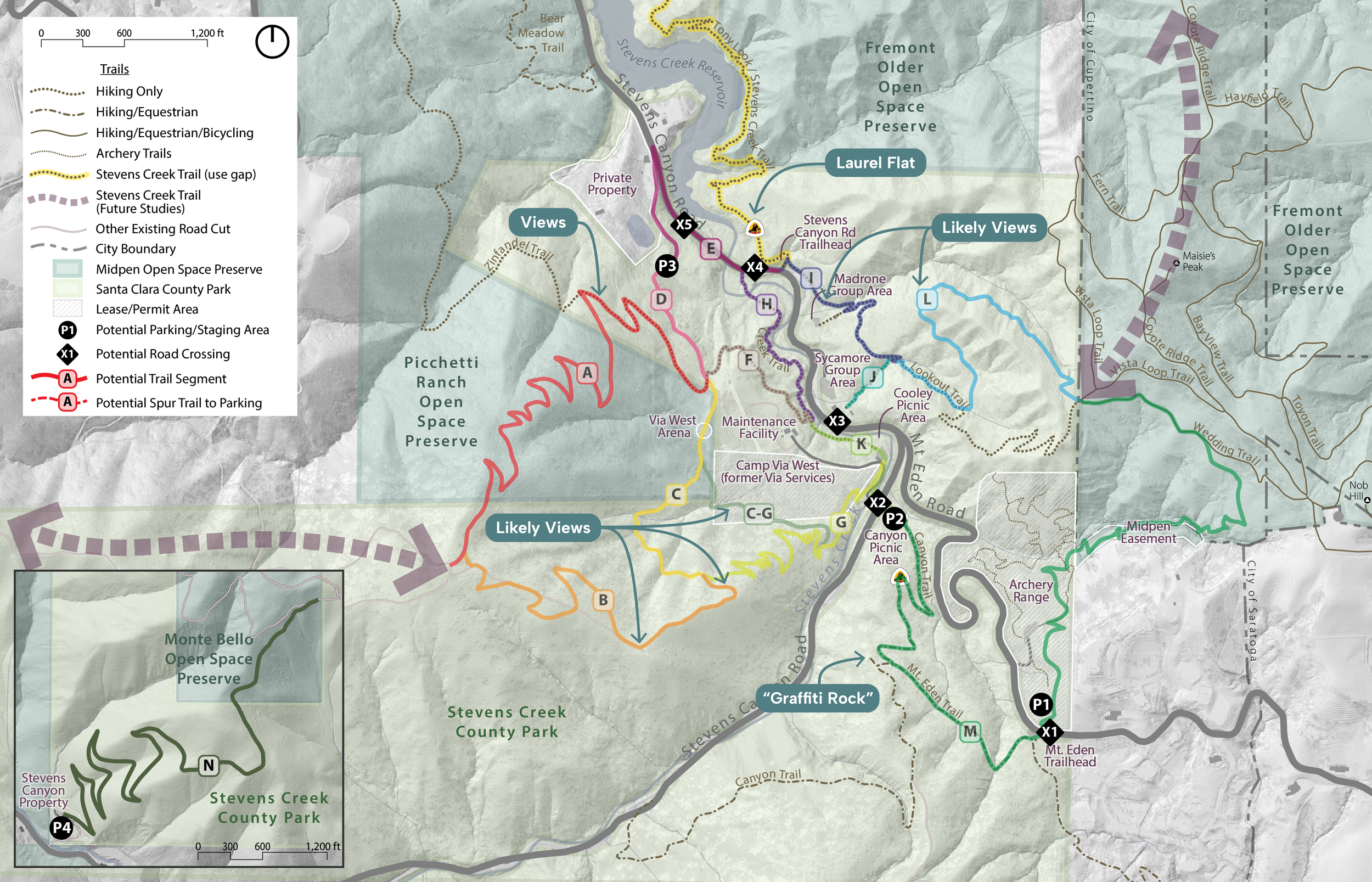
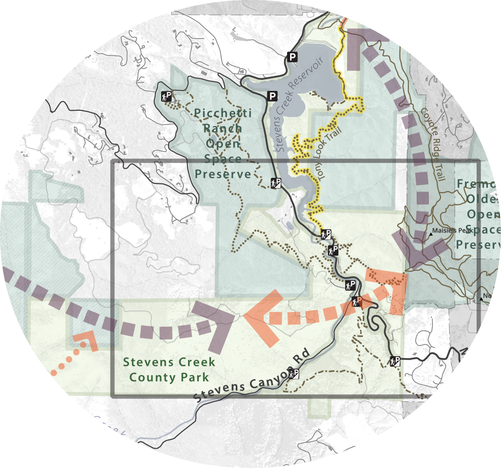
Zander Westbrook Design worked with the Santa Clara County Parks and Recreation Department (Santa Clara County Parks) and the Midpeninsula Regional Open Space District (Midpen) to develop plans for a new multi-use trail connecting Stevens Creek County Park and Upper Stevens Creek County Park. The project included analysis of opportunities and constraints related to parking areas, road crossings, and trail connections to support closing an important gap in the regionally significant Stevens Creek Trail.
Key design challenges included closing trail gaps across a complex landscape with steep grades, narrow existing trail segments, sensitive biological resources, historic landslide areas, and fault zones. Additional constraints included minimizing switchbacks to maintain a functional multi-use experience for cyclists, as well as navigating easements and adjacent private property limitations.
In response to these constraints, our team created and evaluated a range of alignment alternatives. Each alternative considered the need for new road crossing(s) and additional parking, either by expanding existing lots or developing new trailhead facilities. From this analysis, three potential routes were identified for further study to determine the preferred alignment for the final connection.
The Stevens Creek Trail is a Bay Area bike and pedestrian trail connecting parks, open spaces, and regional trails across Mountain View, Sunnyvale, Los Altos, and Cupertino.
Client: Santa Clara County Parks and Recreation Department
Project Dates: 2025 - 2026